Posts for this topic...
-
Post your comments.... Sign In to Post
-
plotaroute admin Tuesday 27 Jun 2023 15:08:00
We're very excited to announce an awesome innovative new feature for our Premium members - Road Side Route Plotting.
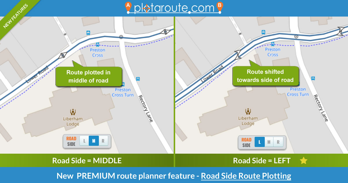
The new Road Side feature shifts your route towards the left or right side of the road as you plot it. This can result in more accurate measurements, as we usually walk, run or ride near the side of the road rather than down the middle, and it can make routes clearer to read where outbound and return sections of a route overlap, by separating overlapping lines on the map.
Take a look at the following example to see the effect.

The Road Side feature is available on both the desktop and mobile route planners and can be used whenever the Auto-Plot switch is turned on - just select the relevant Road Side setting and plot points by clicking on the middle of the road, as you would normally. Your route will automatically shift towards the side of the road you selected.
We recommend that you set the Road Side switch to "M" (middle of the road) when plotting on narrow ways, like footpaths or cycle paths, and aim near the middle of the road when you plot on roads with "L" (left) or "R" (right) selected, to avoid accidentally plotting on pedestrian or cycle ways at the side of the road.
We've made the new switch easily accessible so that you can quickly change it, for example if part of your route takes you onto a footpath.
This new feature is primarily designed for use when plotting new routes, but if you want to make the same change to a route you've already plotted, you can use our Shift Route tool in the route planner to do this. Premium users can also use our Snap Route to Map feature in conjunction with the Road Side feature, to adjust existing routes.
For more information about Premium membership, please visit our Membership page.
-
Mark Worthington Tuesday 27 Jun 2023 19:03:14
Wow, the useful updates keep-a-comin'. Great idea and implementation!!
-
Rich Warren Thursday 29 Jun 2023 09:15:52
Fab feature - are you watching me? :-)
Only last week I was having to manually plot tracks to get the correct side of the road for accessible routes (wheelchair ramps, drop curbs etc.). This feature will make it easier in future.
If only there was a dataset for indicating where accessible pavement features exist as it's not as obvious as you would think in the real world.
@RunningSeeds
-
plotaroute admin Friday 30 Jun 2023 08:37:01
Ha ha, no, not we're not watching you! That's great to hear Rich - thanks for that feedback.
- 1
