Posts for this topic...
-
Post your comments.... Sign In to Post
-
plotaroute admin Thursday 29 Dec 2022 16:42:54
Hi Antonio - we're investigating, it looks like there may be a data void in your area with the new data. If so, we'll revert back to the old data for that area.
-
Paul Toigo Thursday 29 Dec 2022 16:16:00
@Antonio Ratao
Click on "Hills"
[IMAGE REMOVED DUE TO SIZE]
Voila!
[IMAGE REMOVED DUE TO SIZE]
-
Antonio Ratao Thursday 29 Dec 2022 15:05:56
Now, plotaroute doesn't show elevation profile, and even does not inform total ascend
-
Paul Toigo Tuesday 27 Dec 2022 20:04:13
Thank you! On my sample climb of the Poudre Canyon in Colorado USA, the model is much better. While it still has sawteeth that don't exist, the timer model no longer predicts "time travel". More testing soon.
-
eky moz Tuesday 27 Dec 2022 14:17:45
-
Mark Worthington Thursday 22 Dec 2022 16:16:59
Another great upgrade, thanks!
-
plotaroute admin Wednesday 21 Dec 2022 11:26:00
We are very pleased to announce a major upgrade of the data we use to calculate elevation profiles and ascent statistics. This has been made possible following our recent server upgrade, which has enabled us to implement data at a much higher resolution for the whole of North America, Western Europe and New Zealand. We have also implemented enhanced data for many other parts of the World. The new data will enable us to provide more accurate elevation profiles and ascent calculations.
To maintain consistency and comparability, we will be recalculating the ascent statistics for all existing routes, so you may notice some of these figures changing. This is a big exercise, as we have more than 1.5 million routes on our database, so we anticipate that this will take several months, but priority will be given to routes belonging to Premium members and those that are most popular. Until this has completed there may be some inconsistencies between ascent figures shown in different sections of the website for older routes, but any new routes you create will have ascent statistics based on the new elevation data.
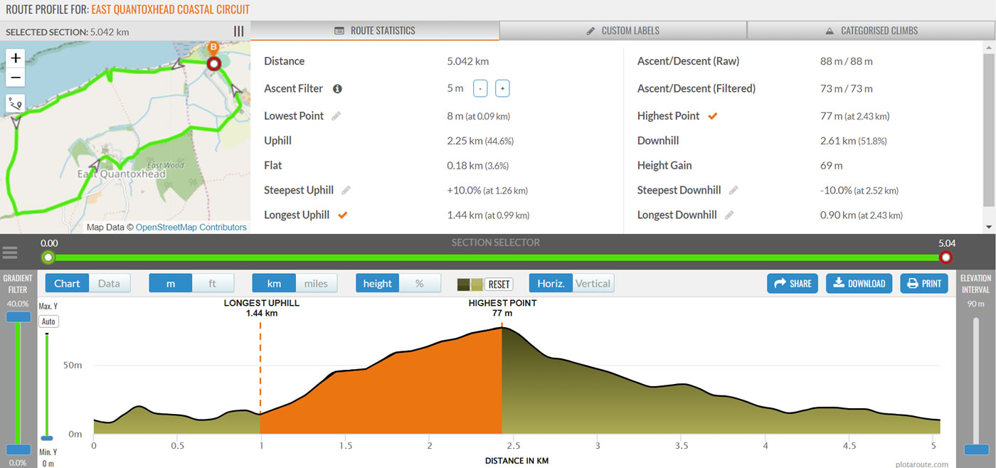
Alongside the data upgrade, we have also implemented some enhancements to our Route Profile tool. This now includes an Ascent Filter, which gives you the option of ignoring small changes in elevation when calculating the total ascent over a route, and also a Gradient Filter, which you can use to smooth gradients that fall outside of a set range. These types of filters are sometimes used by other applications and GPS devices. While we always advise against comparing ascent calculations from different sources, as they are all calculated differently, you can use these filters to examine how different levels of filtering can affect ascent calculations.

