Posts for this topic...
-
Post your comments.... Sign In to Post
-
Carlo Baldissera Thursday 04 Jul 2019 10:44:06
I LOVE it!!!! Now Plotaroute is THE software for planning routes.
-
Pierre Chartier Wednesday 03 Jul 2019 09:52:31
Nice improvement. I like it.
-
Peter Höglund Sunday 09 Jun 2019 09:24:09
Nice enhancement! I will try to utilize it.
Even though my navigation device (fenix5X) can't handle a mixture of direction- and 'other' course points to well.
It only gives me time and distance to the next course point. If I have a direction on my climb, then I can't see how far the top is.
-
plotaroute admin Thursday 06 Jun 2019 14:10:29
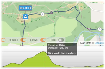
Following an excellent suggestion on the forum, we've now made it possible to add directions to a route by clicking on the hill profile in the route planner. This makes it easy to locate directions at points on the route where there are significant changes in elevation, like the summit or base of a hill.
In addition, when you're viewing a route on the View Route page, clicking on a point on the hill profile will now zoom in to that point on the route. We've also added the same click-to-zoom feature to the table of directions, as well as making a few other tweaks along the way. These are all fairly simple changes to the site, but hopefully they should make a big difference when adding and reviewing directions.

- 1
